Chart-Holy Land: New Testament (Laminated Sheet) (19.5″ x 26″)
Product Description
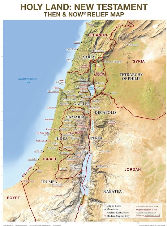
Rose Publishing’s Then and Now® Relief Maps show the physical details of Bible places including mountains, valleys, rivers, and deserts. See where Bible places are today: red print lines show the major cities and boundaries of modern countries. This relief map focuses on the land of Israel in the New Testament time, with present-day locations overlaid in red.
Features:
• Printed on heavy chart paper and laminated for durability; you can use water soluble markers to... Show More write on and wipe off with ease.
• Easily see the Holy Land of the New Testament in both Bible times and present day
• Includes reproducible worksheets on the back, a great reference tool for classrooms and teaching
Product Specifics
Item ID:
672213
ISBN-10:
1628627484
ISBN-13:
9781628627480
Speedy:
143451
UPC:
031809070314
Customers Also Bought

$7.20
$9.00

$14.98
$14.99

$11.89
$16.99